Wanakena Trail
Wanakena Trail
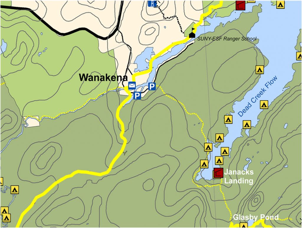
Leaving the trailhead/gate (where it is a good place to register) for the High Falls Loop, walk a couple hundred feet along a spur road towards town and turn right on South Shore Road. Walk past the tennis court to the trailhead parking area. Across the street from the parking area is a foot trail leading to a suspension bridge. This historic landmark bridge will take you across the Oswegatchie River and into the hamlet of Wanakena.
Note that a public restroom (seasonal) is available in the town square, as well as a soda vending machine. There is also a post office and a friendly convenience store/art gallery called Otto’s Abode.
To continue on the CL50, hike north/straight from the suspension bridge along 2nd Street about 0.2 miles. Make a right onto Ranger School Rd, which more or less parallels the Oswegatchie River. On your way down Ranger School Road you will pass the popular Pine Cone Grill and their gift shop called The Trading Post. About 1 mile further on you will reach the SUNY-ESF Ranger School, home of 3 Associate’s Degree programs and 2 summer programs in forestry and natural resources management. Hike past the front of the school, past the canoe racks and look for a trail entering the forest on your right marked as Ranger School Trail #1. It is also marked as the Peavine Swamp Trail, so you will see some DEC signage there and, of course, blue CL50 markers.
Total distance from the High Falls trailhead to the Peavine Swamp trailhead is about 2 miles, and this section is marked with large-diameter blue CL50 discs.
See full map here
Get your Cranberry Lake 50 Hiker’s Map
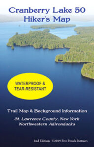
Get your Cranberry Lake 50 Hiker’s Map contains an updated map and lots of information to help you plan your trip. Download here or get this waterproof, tear-proof map for $9.95 at the following locations:
Adirondack Mountain Club, Lake Placid and Lake George
Adirondack Hamlets to Huts, Saranac Lake
The Bookstore Plus, Lake Placid
Grass River Outfitters, Canton
Hoss’s Country Store, Long Lake
Birch’s Lakeside General Store
Campground, & Marina, Cranberry Lake
Otto’s Abode, Wanakena
Raquette River Outfitters, Tupper Lake
Sevey’s Point, Childwold
St. Lawrence Co. Chamber of Comm., Canton
St. Regis Outfitters, Saranac Lake
Stone Manor Diner/Motel, Cranberry Lake
The Mountaineer, Keene Valley
U-Bs Mercantile, Oswegatchie
Get your patch!
When you complete the entire loop let us know and we will add your name to our list of finishers!
Just want the patch? Send minimum $5 donation to FIVE PONDS PARTNERS, PO Box 183, Wanakena, NY 13695
Make checks payable to FIVE PONDS PARTNERS.