FAQ
Who are the Five Ponds Partners?
“Cranberry Lake 50 is a project of Five Ponds Partners (an all-volunteer subcommittee of the Clifton-Fine Economic Development Corporation). We are dedicated to maintaining and sharing the beauty and recreational resources of the northwest Adirondacks.”
How do I get my name listed on the website and get a patch?
Fill out a form here and we’ll take care of the rest!
Where can I find information about Cranberry Lake Businesses?
See our Area Businesses List
Where can I find more information and maps to help plan my trip?
See our Planning Your Trip page
What are the current trail conditions?
The Five Ponds Partners do not have the resources to provide up-to-date trail conditions at any given time of year, nor does the NYS-DEC in our opinion. For general conditions, try the DEC website, and/or the Adirondack Almanack website. In addition, people who have recently completed the CL50 often post about trail conditions on the Cranberry Lake 50 Facebook page. Note that these posts represent opinions, and the posts are not monitored for accuracy by anyone. Local Forest Rangers may be another source of info about trail conditions, as are local guides (who can be hired to help plan or lead your trip).
How is the CL50 trail marked?
The trail is marked with circular, plastic discs of various colors. Each distinct section of trail is marked with a unique color. In addition to these markers, the entire 50-mile loop is marked with circular, royal blue markers, about every few hundred feet or so. Along roads and highways, a larger diameter circle marker is used. Brown signs with yellow arrows are occasionally used at trail intersections and sharp turns. Never rely on trail markers alone. Always bring a map and compass and/or GPS receiver.
How long will it take me to complete the CL50?
A 3-day, 2-night option is popular, but many find that 4-5 days is more relaxing and enjoyable. Even if carrying a heavy pack, the well-marked, well-maintained, gently rolling trails facilitate steady progress. However, as you will see on the map, there are several possibilities for dividing the route into reasonable distances based on time available, interest, ability, season and preferred mode of travel (e.g, hike, bike, ski). Some people spread the adventure over several years, doing only one or two small sections a year. Some have completed the loop in less than 24 hours! However, no official speed records are maintained or celebrated; the primary purpose of trail is to provide a relaxing opportunity to reconnect with nature, friends, and one’s own physical and spiritual health. Your CL50 experience can be customized and enhanced by including one or more side trips (refer to CL50 Pocket Guide). These will surely require additional time beyond the typical 3-4 day trip, so be sure to plan accordingly.
Will I need a bear canister to store my food?
Black bears do inhabit the area, and they are occasionally spotted along the CL50. It is wise to use a canister, for protection against bears and other critters. At the very least, hang your food out of reach of bears, and away from your campsite. Do not store food in tents, nor wear clothes that smell of food in your tents.
Is cell service available along the CL50?
Cell service continues to improve, but remains spotty, weak or non-existent through much of the area. The higher in elevation you are, the better your chances for reception. You will likely not have service while hiking through the hamlet of Wanakena, but you may be able to use a phone at an area business in an emergency. You should have service while hiking through the hamlet of Cranberry Lake. Elsewhere, you may get one bar of service or none, so plan and prepare accordingly.
If I can’t find an available lean-to or campsite, where should I camp?
Camping is only allowed on the State lands traversed by the CL50 (not on private lands). Please review the list of State Land Regulations here, which includes rules pertaining to camping.
Which direction should I go, clockwise or counter-clockwise?
See our “Cranberry Lake 50 Trail” page.
How many people have completed the CL50 to date?
Visiting the current year of the “Trail Completions” page will give you an idea of how many folks have completed the trail. Note that the list is updated every few months or so.
How much does a CL50 patch cost?
CL50 patches are issued to people who have completed the entire loop trail. The FPP asks for a minimum $5 donation to cover the patch plus shipping/handling. Many hikers send in more than the minimum in support of the FPP and their continuing efforts to improve access, quality and promotion of the recreational resources in the Clifton-Fine region.
How do I get more information?
Email jmsavage@esf.edu but please note that it may take a few days to get a response. You are dealing with awesome volunteers that have many other family and job responsibilities.
Get your Cranberry Lake 50 Hiker’s Map
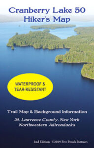
Get your Cranberry Lake 50 Hiker’s Map contains an updated map and lots of information to help you plan your trip. Download here or get this waterproof, tear-proof map for $9.95 at the following locations:
Adirondack Mountain Club, Lake Placid and Lake George
Adirondack Hamlets to Huts, Saranac Lake
The Bookstore Plus, Lake Placid
Grass River Outfitters, Canton
Hoss’s Country Store, Long Lake
Birch’s Lakeside General Store
Campground, & Marina, Cranberry Lake
Otto’s Abode, Wanakena
Raquette River Outfitters, Tupper Lake
Sevey’s Point, Childwold
St. Lawrence Co. Chamber of Comm., Canton
St. Regis Outfitters, Saranac Lake
Stone Manor Diner/Motel, Cranberry Lake
The Mountaineer, Keene Valley
U-Bs Mercantile, Oswegatchie
Get your patch!
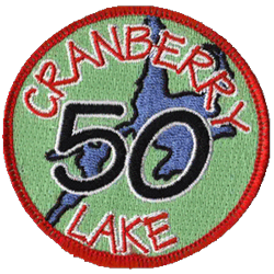
When you complete the entire loop let us know and we will add your name to our list of finishers!
Just want the patch? Send minimum $5 donation to FIVE PONDS PARTNERS, PO Box 183, Wanakena, NY 13695
Make checks payable to FIVE PONDS PARTNERS.